
Time to make The Fusion
In the X-PAD Fusion Bootcamp, our Product Experts will take you through different surveys with TPS/GNSS, scanners, and drones. Each webinar will be dedicated to multiple applications performed on the same site with the various sensors, e.g., surveying Golf field bunkers perimeters, scanning a façade.
In this webinar, we will analyze and compare all the data gathered during the previous episodes of our X-PAD Fusion Webinar Series.
You will learn:
- How to compare surfaces captured with drone and GNSS
- Manage data gathered with various types of equipment, all on a single platform
- Export data from software to share it with external partners or customers
- Use Ribbon Design 3D Tool to create new projects
During the entire webinar, you will have the opportunity to ask questions in the chat. At the end of the webinar, our experts will answer them in the Q&A session.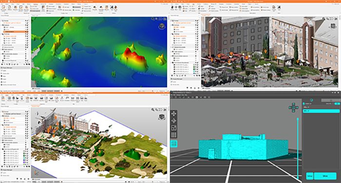
Register to the webinar and invest time in yourself and your skills to make your work life more efficient and pleasant.